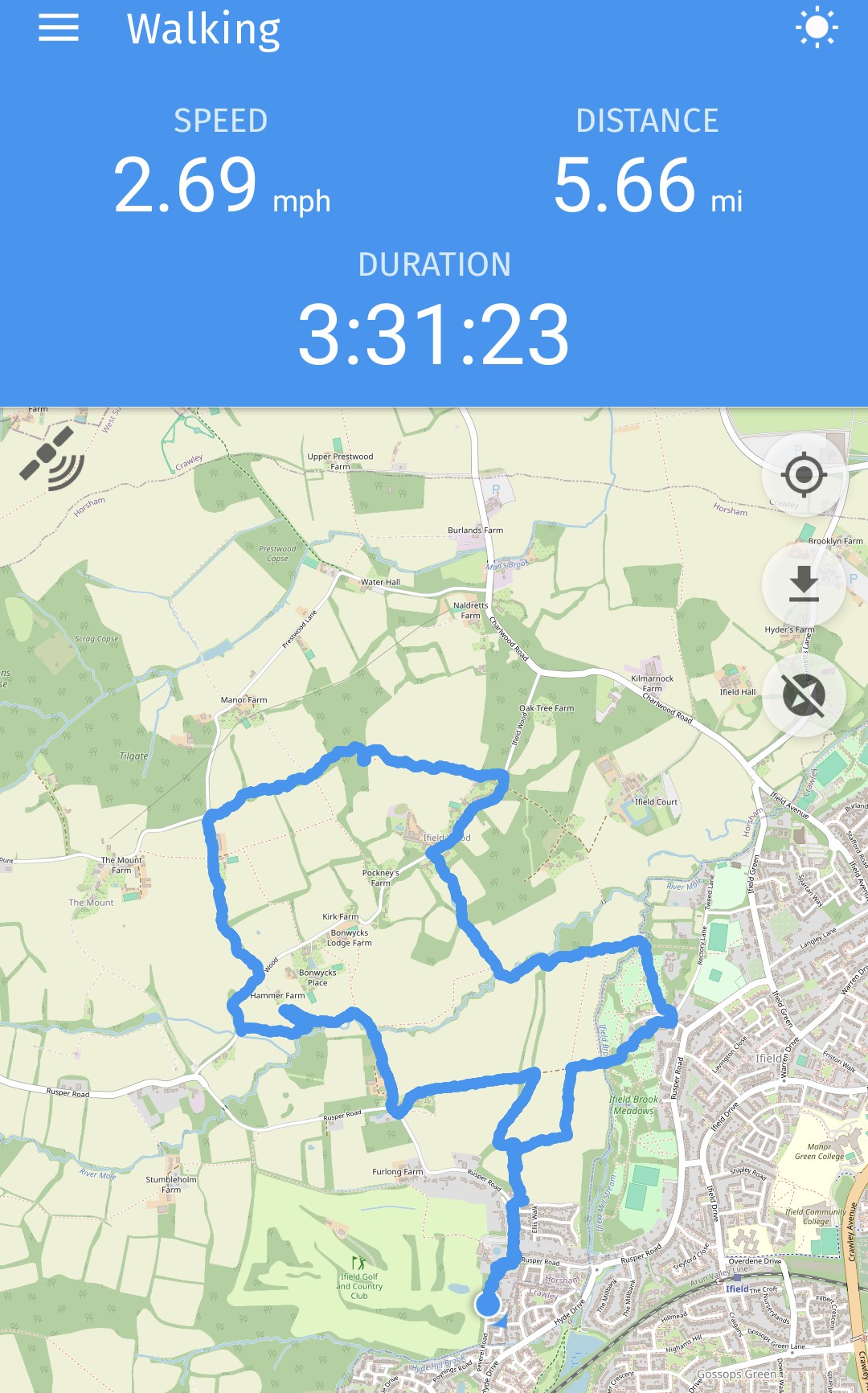
A five and a half mile circular walk from Ifield West to The Plough via Ifield Wood
16 July 2025
65 photos
|
65 photos from a five and a half mile circular walk from Ifield West to The Plough via Ifield Wood including a map and brief commentary.
The duration includes lunch!
Our walk started in Ifield West. We crossed Rusper Road at the bottom of Whitehall Drive and cut through the gap to the north of the Maples development into the wheat fields of Ifield Court Farm.
Having Navigated oyur way around the edge of the wheat fields we joined the track from the church to Pound Cottages
Pound Cottages
If looks could kill...
Old Pound Cottage, a 17th century or earlier cottage that was recently compulsorily purchased by Homes England.
One of the old Parish pounds
We then turned right along the public footpath which leads to Ifield Wood and Bonwyckes.
Bonwyckes Farm
A new bridge!
Bonwyckes Place where, in 1655 at a meeting which was attended George Fox (a founder of the Society of Friends) and Alexander Parker, the seeds of the Friends Meeting House in Langley Lane were sown.
We elected to turn left past Bonwyckes to join Ifield Wood
Hillybarn
Opposite The Mount we turned right onto the ridge path towards Burlands Copse
Russ Hill Hotel
Manor Farm on Prestwood Lane
Lower Prestwood Farm, of the 18th century
Manor Farm again
The view from Burlands Copse across to Gatwick Airport
The foot of the descent from Burlands Copse
After rejoining Ifield Wood (the road) we turned right, heading south-westwards
Oak Lodge in Ifield Wood, the left portion of which dates to the 1700s. We then took the public footpath beside Oak Lodge to head south back towards the fields of Ifield Court Farm
Looking back towards Oak Lodge from the south
Looking south-westwards at Lower Barn, near Pound Cottages
The circular earth work of unknown purpose which sits below Ifield Court next to the River Mole
Ifield Brook Meadows
The junction of Rusper Road and Whitehall Drive, taken from the entrance to Ifield Golf Club
Text & photographs © Ian Mulcahy. Contact photos@iansapps.co.uk or visit my 'Use of my photographs' page for licensing queries (ground level photographs only). |